What is the GPS for?
One can use a GPS in conjunction with photography to create a more accurate mapping of where pictures were taken. There are all manner to brands and sizes of GPS. Some cameras have it built-in, some offer it as an add-on accessory. If you don’t want or like those options, you can always get an external device that is unrelated to the camera, or, if you wish, use an app on your phone.
Why would you want a GPS accurate track of where you went? Perhaps you want to be able to go back to the same place at a different time. Perhaps you wish to share information with other people about where you went so they can go there too. Maybe you want to keep track of all the places you been and plot them on a map, perhaps even “checking off” certain places. There are many reasons why you might wish to use a GPS with your travels.
GiSTEQ
Initially, I started with a GPS unit from GiSTEQ. It was smallish, about the size of a business card, and about 3/4" thick, had USB and Bluetooth. I got it used, and after a year or so, the battery wouldn’t last for more than a couple hours. It used a custom battery. Not so wonderful. Time to look for something better. My requirements were that it produce simple and easy to access logs in standard format, use a readily replaceable battery, and be small and light weight enough I could attach it to my camera bag when I’m out and about, and not notice it.
myTracks
I didn’t find anything right away that was an external unit, but I did find an app for my (Android) phone called myTracks. The app is simple, fire it up, tell it to record, do your thing, tell it to stop, and then “share” the log (you can share it by exporting - gpx or kml, to the flash, which is then accessible via usb, bluetooth, or email). I used this for a few trips, but found that running the GPS on the phone kills the battery right quick. Less than stellar.
Sony GPS-CS1
I went a little while longer w/o a GPS and then I found a reference on The
Luminous Landscape
to a Sony GPS-CS1. Its relatively small, runs for 10-14hrs on a single AA,
mounts as a USB and writes everything to a plain text log file. Sounded too good
to be true. I found one for approx. $20 on
Ebay and took a chance. It
works great with myTracks (on the desktop). The author of the article said it
also works with Downloader Pro2 (Windows), if you are able to cope with Windows,
that could be a reasonable choice.
Back home
Back at my computer, I use the desktop version of myTracks to do the actual geo-coding of the images. I drag the log file in to myTracks, select the track, and then drag my RAW (CR2) files on to myTracks and it will either edit the RAW file for you, or it generates XMP sidecar files for each picture. I can optionally have myTracks add keywords for the locations (city, state, country) as well. Then I import the RAWs into Adobe Lightroom and it slurps in the XMP sidecar information along with the RAW. I’ve been using it for about a month now and all I can say is brilliant.
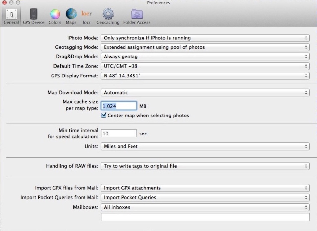
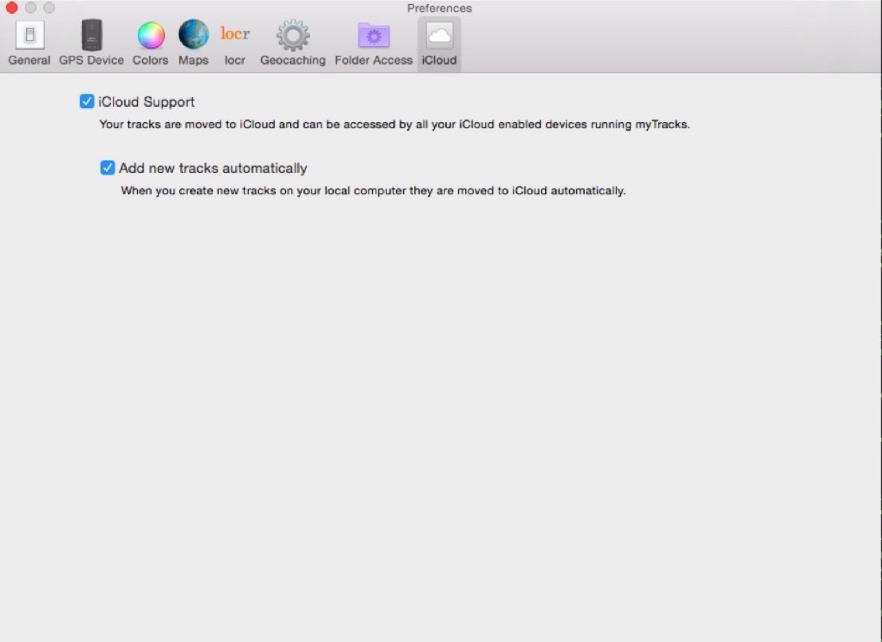
Desktop screenshot

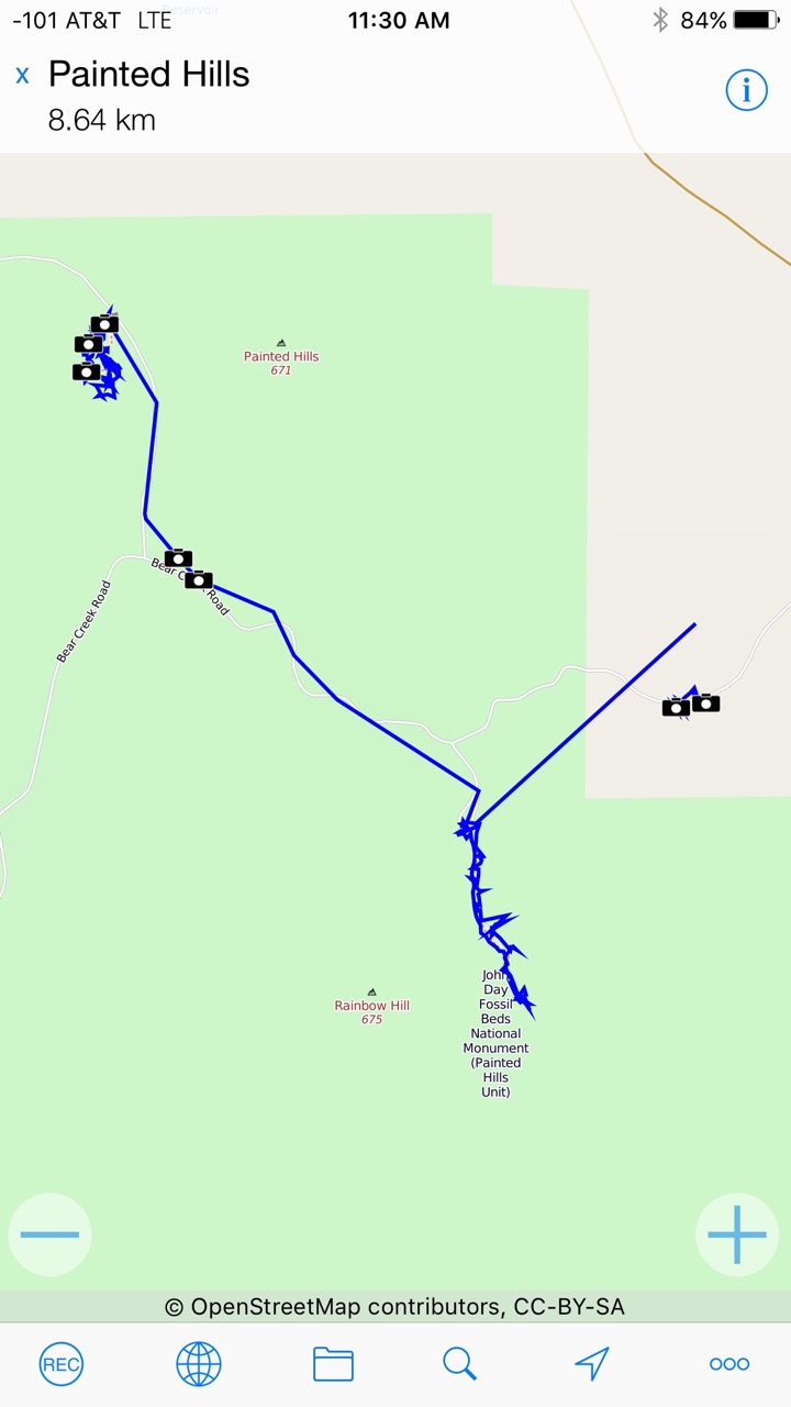
Phone screenshot
myTracks Settings
Here are the settings I’ve used with the Sony GPS-CS1
Preferences (General)
Preferences (GPS)

Preferences (iCloud)
UPDATE Dec. 09, 2012
I have now moved from Android to an iPhone. Both offered the ability to run myTracks, but the iPhone has the advantage of battery life that allows reasonable use. The iOS app will sync tracks with the desktop app (they have a build-in mode, and also support iCloud). Handy.